
Earthquake details
Earthquake event details
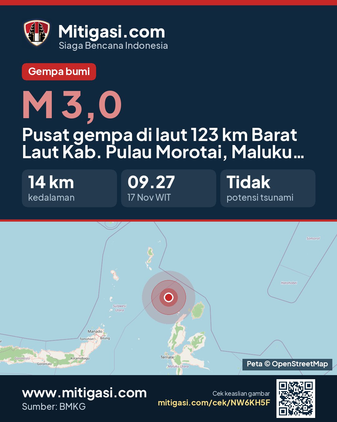
3.0
SR (Richter scale)
Location
Epicentre at sea, 123 km northwest of Kab. Pulau Morotai, Maluku Utara
Date
17 Nov 2026
Time
08:27:18 WITA
Depth
14 km
Coordinates
2.7880000, 127.4320000
Tsunami status
This earthquake has no tsunami potential.
Epicentre location
Other recent earthquakes
See all →2.2
Epicentre at sea, 41 km southwest of Kab. Pulau Morotai, Maluku Utara
17 Nov 2026 08:20
→
2.7
Epicentre at sea, 73 km north of Kab. Manggarai Timur, Nusa Tenggara Timur
17 Nov 2026 08:19
→
3.3
Epicentre at sea, 96 km southwest of Kota Tual, Maluku
17 Nov 2026 08:18
→
2.0
Epicentre at sea, 39 km north of Kab. Manggarai Timur, Nusa Tenggara Timur
17 Nov 2026 08:15
→