
Mount Sinabung
Sumatera Utara · 2.460 m a.s.l.
Recommendations
2. Masyarakat yang berada dan bermukim di dekat sungai-sungai yang berhulu di G. Sinabung agar tetap waspada terhadap bahaya lahar.
3. Pemerintah Daerah Kabupaten Karo agar senantiasa berkoordinasi dengan Pusat Vulkanologi dan Mitigasi Bencana Geologi atau Pos Pengamatan Gunung api Sinabung
Latest report
24-hour report, 2026-10-23, 00:00-24:00 WIB · Panca Praygia Perangin Angin, A.Md.T.
Visual observation
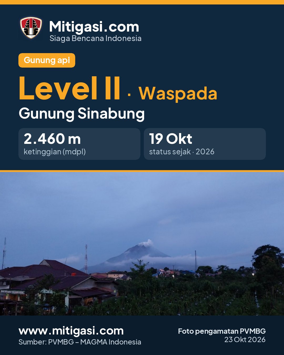
The volcano is clearly visible to covered by fog 0-III. Main crater smoke observed: white with thin to moderate intensity, rising about 100-200 meter dari puncak.
Climatology
Weather cloudy to rain, weak wind to moderate towards east and west. Air temperature about 15-25°C.
Seismicity
- 1 Local tectonic event, amplitude 20 mm, S-P 4.1 s, duration 26 s.
- 3 Distant tectonic events, amplitude 6-22 mm, S-P 18-26 s, duration 48-63 s.
Observation photo

Latest observation photo.
- Location
- Karo, Sumatera Utara
- Nearest city
- Kabanjahe, Berastagi
- Elevation
- 2.460 m a.s.l.
- Coordinates
- 3.1700000, 98.3920000
Observation-post CCTV
Snapshots are updated about every 15 minutes. The capture time is shown in the top-left corner.


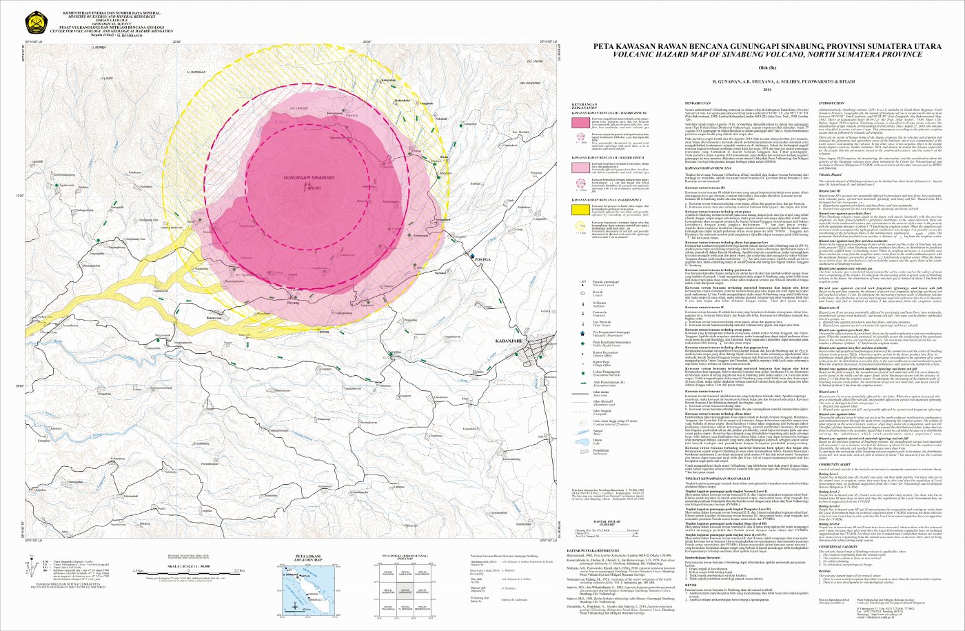
Volcanic hazard map (KRB)
Official Geological Agency map (2015): areas that may be hit by pyroclastic flows, lava flows, ballistic rocks, ashfall, and lahars. KRB III is closest to the source.
14-day seismicity chart
Volcanic earthquakes per day by type.
View data table
| Date | Emission | Deep volcanic | Hybrid/multiphase | Local tectonic | Distant tectonic | More |
|---|---|---|---|---|---|---|
| 25 Oct | 0 | 0 | 0 | 0 | 0 | 0 |
| 24 Oct | 0 | 0 | 0 | 0 | 0 | 0 |
| 23 Oct | 0 | 0 | 0 | 1 | 3 | 0 |
| 22 Oct | 1 | 2 | 0 | 0 | 5 | 0 |
| 21 Oct | 1 | 4 | 0 | 0 | 5 | 0 |
| 20 Oct | 0 | 2 | 1 | 0 | 3 | 0 |
| 19 Oct | 2 | 4 | 1 | 0 | 5 | 1 |
| 18 Oct | 1 | 5 | 0 | 0 | 2 | 0 |
| 17 Oct | 0 | 0 | 0 | 0 | 0 | 0 |
| 16 Oct | 0 | 0 | 0 | 0 | 0 | 0 |
| 15 Oct | 0 | 0 | 0 | 0 | 0 | 0 |
| 14 Oct | 0 | 0 | 0 | 0 | 0 | 0 |
| 13 Oct | 0 | 0 | 0 | 0 | 0 | 0 |
| 12 Oct | 0 | 0 | 0 | 0 | 0 | 0 |
Satellite imagery
Previous reports
24-hour report, 2026-10-22, 00:00-24:00 WIB
Visual: The volcano is clearly visible to covered by fog 0-III. Main crater smoke observed: white with thin, moderate to thick intensity, rising about 100-300 meter dari puncak.
- 1 Emission event, amplitude 2 mm, duration 31 s.
- 2 Deep volcanic events, amplitude 3-20 mm, S-P 1.2-3.5 s, duration 12-25 s.
- 5 Distant tectonic events, amplitude 2-14 mm, S-P 17-114 s, duration 35-1474 s.
24-hour report, 2026-10-21, 00:00-24:00 WIB
Visual: The volcano is clearly visible to covered by fog 0-III. Main crater smoke observed: white with moderate to thick intensity, rising about 100-400 meter dari puncak.
- 1 Emission event, amplitude 2 mm, duration 21 s.
- 4 Deep volcanic events, amplitude 2-16 mm, S-P 1-2.5 s, duration 5-15 s.
- 5 Distant tectonic events, amplitude 2-7 mm, S-P 18-22 s, duration 38-96 s.
24-hour report, 2026-10-20, 00:00-24:00 WIB
Visual: The volcano is clearly visible to covered by fog 0-II. Main crater smoke observed: white with moderate to thick intensity, rising about 100-500 meter dari puncak.
- 1 Hybrid/multiphase event, amplitude 5 mm, S-P not observed, duration 25 s.
- 2 Deep volcanic events, amplitude 2 mm, S-P 1-1.6 s, duration 8-8.5 s.
- 3 Distant tectonic events, amplitude 5-80 mm, S-P 17-33 s, duration 45-243 s.
24-hour report, 2026-10-19, 00:00-24:00 WIB
Visual: The volcano is clearly visible to covered by fog 0-III. Main crater smoke observed: white with moderate to thick intensity, rising about 200-400 meter dari puncak.
- 2 Emission events, amplitude 2-20 mm, duration 16-17 s.
- 1 Hybrid/multiphase event, amplitude 2 mm, S-P not observed, duration 12 s.
- 4 Deep volcanic events, amplitude 2-20 mm, S-P 1.2-2.5 s, duration 7-16 s.
- 5 Distant tectonic events, amplitude 2-12 mm, S-P 17-23 s, duration 45-234 s.
- 1 Getaran Banjir event, amplitude 60 mm, duration 5259 s.
24-hour report, 2026-10-18, 00:00-24:00 WIB
Visual: The volcano is clearly visible to covered by fog 0-III. Main crater smoke observed: white with thin, moderate to thick intensity, rising about 100-500 meter dari puncak.
- 1 Emission event, amplitude 4 mm, duration 35 s.
- 5 Deep volcanic events, amplitude 2-20 mm, S-P 1.5-2.7 s, duration 10-17 s.
- 2 Distant tectonic events, amplitude 6-7 mm, S-P 11-36 s, duration 42-84 s.
Level history
No level changes recorded since monitoring began.