
Mount Rokatenda
Nusa Tenggara Timur · 875 m a.s.l.
Recommendations
2. Masyarakat agar senantiasa mengikuti arahan pemerintah daerah setempat serta tidak mempercayai isu-isu mengenai aktivitas G. Rokatenda yang tidak jelas sumbernya.
3. Pusat Vulkanologi dan Mitigasi Bencana Geologi, Badan Geologi akan selalu berkoordinasi dengan BNPB, pemerintah setempat, BPBD provinsi Nusa Tenggara Timur dan BPBD Kab Sikka dalam memberikan informasi tentang aktivitas G. Rokatenda.
4. Masyarakat maupun BNPB, BPBD, provinsi Nusa Tenggara Timur, BPBD Kab Sikka dan instansi terkait lainnya dapat memantau perkembangan tingkat aktivitas maupun rekomendasi G. Rokatenda setiap saat melalui Magma Indonesia yang dapat diakses melalui website https://magma.esdm.go.id atau apps di Android Magma Indonesia yang dapat diunduh di Google Play Store.
Latest report
24-hour report, 2026-10-24, 00:00-24:00 WITA · Ardiyansyah
Visual observation
The volcano is covered by fog 0-III. Crater smoke not observed. Weather clear to overcast, weak wind to moderate towards north, east, southeast, south and southwest. Air pressure not observed.
Climatology
Weather clear to overcast, weak wind to moderate towards north, east, southeast, south and southwest. Air pressure not observed.
Seismicity
- 7 Local tectonic events, amplitude 4.0-47.0 mm, S-P 4.0-6.4 s, duration 22.4-114.0 s.
- 1 Emission event, amplitude 3.0 mm, duration 47.4 s.
- 5 Deep volcanic events, amplitude 4.0-35.4 mm, S-P 2.3-3.9 s, duration 14.4-17.2 s.
- 1 Tornillo event, amplitude 8.0 mm, duration 24.7 s.
Observation photo

Latest observation photo.
- Location
- Sikka, Nusa Tenggara Timur
- Nearest city
- Desa Awa, Kampung Roka
- Elevation
- 875 m a.s.l.
- Coordinates
- -8.3200000, 121.7080000
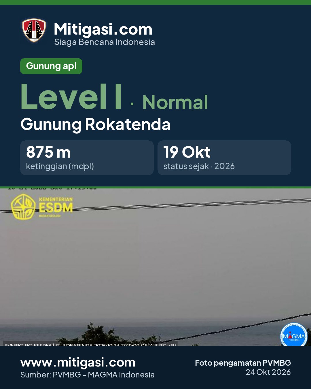
Observation-post CCTV
Snapshots are updated about every 15 minutes. The capture time is shown in the top-left corner.

Live seismograms
Seismograph (helicorder) records from the last 24 hours at 3 PVMBG stations on Mount Rokatenda, updated about every 15 minutes. One line = 30 minutes; the bottom line is the latest. Times on the image are UTC (WIB = UTC+7, WITA = UTC+8, WIT = UTC+9). Click an image for full size.
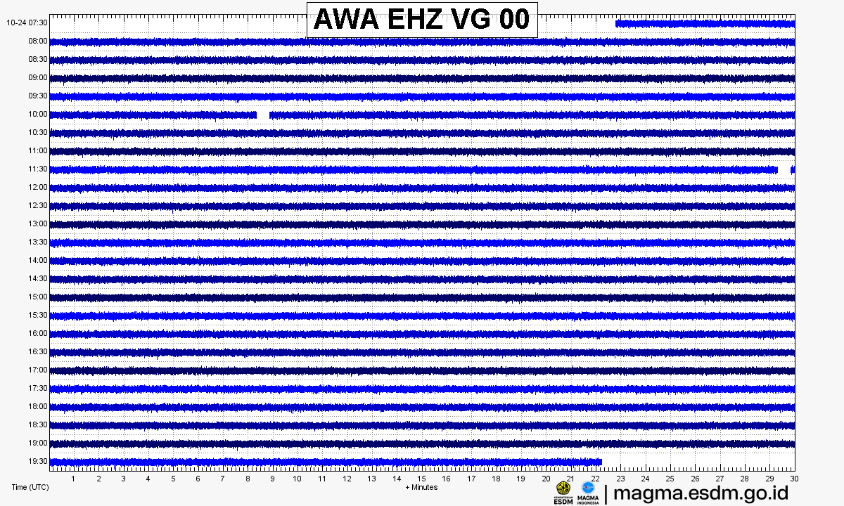
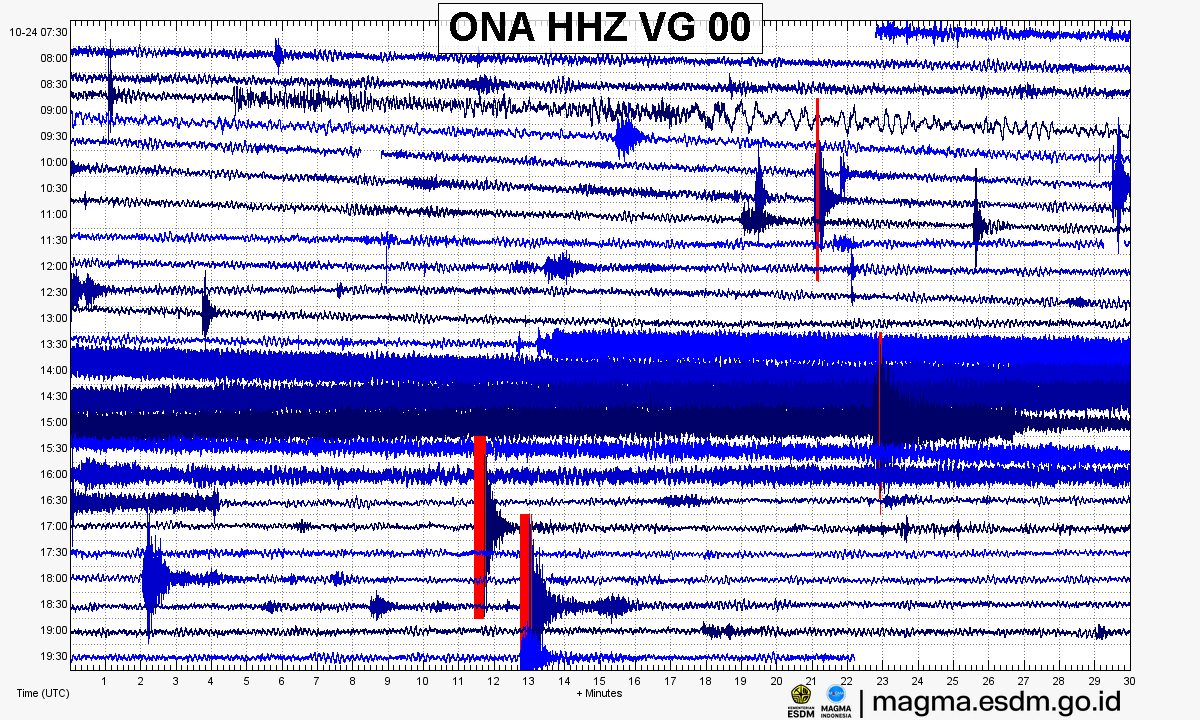
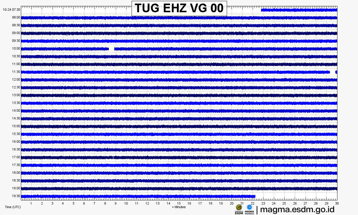
Source: PVMBG – MAGMA Indonesia. Volcanic earthquakes appear as spikes on the trace; continuous shaking may indicate tremor.
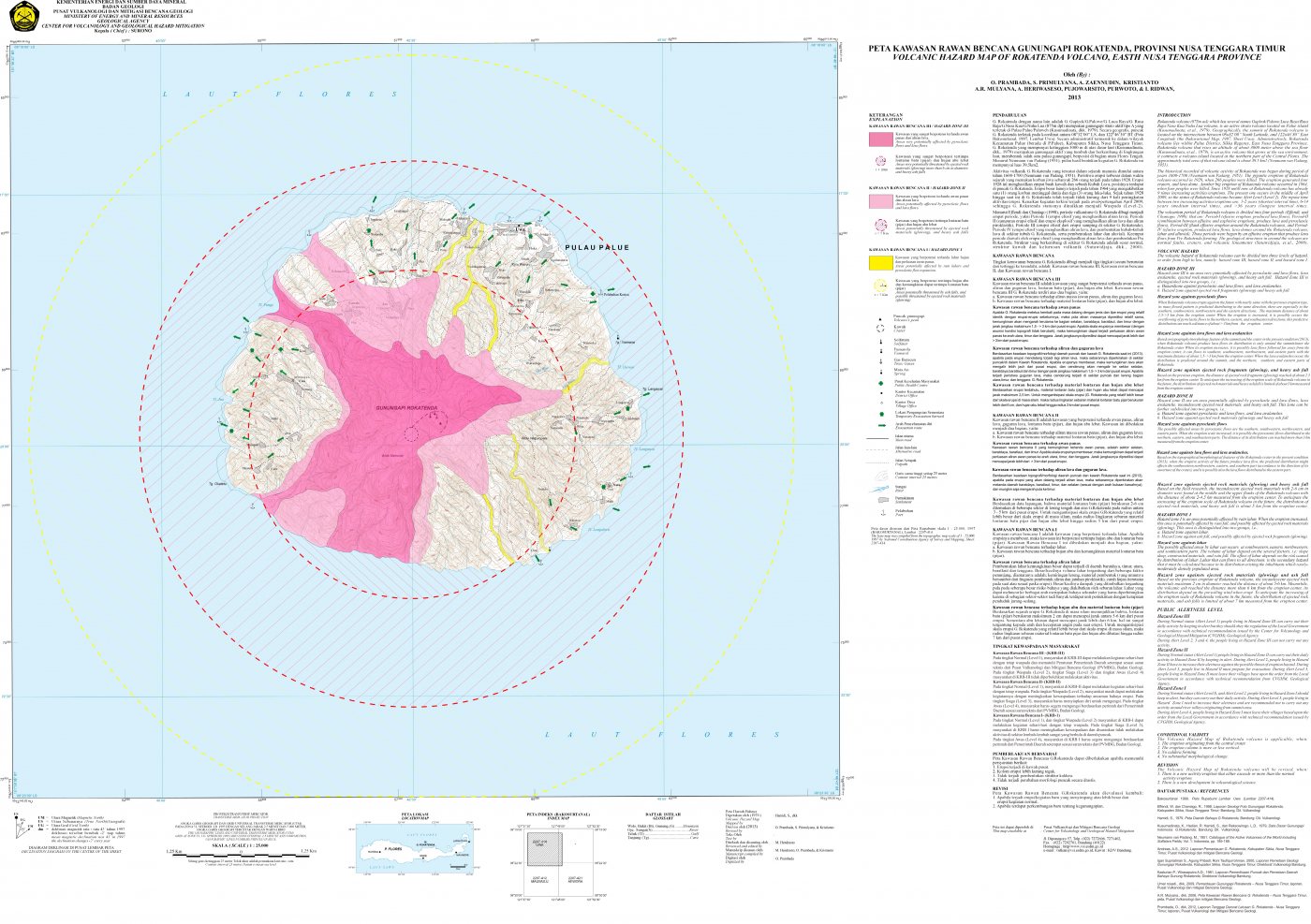
Volcanic hazard map (KRB)
Official Geological Agency map (2013): areas that may be hit by pyroclastic flows, lava flows, ballistic rocks, ashfall, and lahars. KRB III is closest to the source.
14-day seismicity chart
Volcanic earthquakes per day by type.
View data table
| Date | Emission | Shallow volcanic | Deep volcanic | Local tectonic | Distant tectonic | More |
|---|---|---|---|---|---|---|
| 25 Oct | 0 | 0 | 0 | 0 | 0 | 0 |
| 24 Oct | 1 | 0 | 5 | 7 | 0 | 1 |
| 23 Oct | 1 | 0 | 3 | 5 | 0 | 1 |
| 22 Oct | 3 | 2 | 3 | 2 | 2 | 0 |
| 21 Oct | 0 | 1 | 1 | 12 | 5 | 0 |
| 20 Oct | 3 | 5 | 0 | 8 | 4 | 0 |
| 19 Oct | 5 | 1 | 0 | 13 | 6 | 0 |
| 18 Oct | 0 | 3 | 5 | 6 | 1 | 0 |
| 17 Oct | 0 | 0 | 0 | 0 | 0 | 0 |
| 16 Oct | 0 | 0 | 0 | 0 | 0 | 0 |
| 15 Oct | 0 | 0 | 0 | 0 | 0 | 0 |
| 14 Oct | 0 | 0 | 0 | 0 | 0 | 0 |
| 13 Oct | 0 | 0 | 0 | 0 | 0 | 0 |
| 12 Oct | 0 | 0 | 0 | 0 | 0 | 0 |
Satellite imagery
Previous reports
24-hour report, 2026-10-23, 00:00-24:00 WITA
Visual: The volcano is clearly visible to covered by fog 0-III. Crater smoke not observed.
- 1 Emission event, amplitude 2.2 mm, duration 51.6 s.
- 1 Tornillo event, amplitude 2 mm, duration 19.9 s.
- 3 Deep volcanic events, amplitude 3-6 mm, S-P 2.7-3.6 s, duration 12.8-21.1 s.
- 5 Local tectonic events, amplitude 4.7-36 mm, S-P 4-5.7 s, duration 21.2-42.2 s.
24-hour report, 2026-10-22, 00:00-24:00 WITA
Visual: The volcano is covered by fog 0-I to covered by fog 0-III. Crater smoke not observed.
- 3 Emission events, amplitude 2.96-3.7 mm, duration 14-33 s.
- 2 Shallow volcanic events, amplitude 7.4-22.2 mm, duration 16-20 s.
- 3 Deep volcanic events, amplitude 5.9-46.2 mm, S-P 1.7-2.3 s, duration 8-12 s.
- 2 Local tectonic events, amplitude 22.2-29.6 mm, S-P 9-9.7 s, duration 17-20 s.
- 2 Distant tectonic events, amplitude 7.4-10.5 mm, S-P 11-12 s, duration 37-175 s.
24-hour report, 2026-10-21, 00:00-24:00 WITA
Visual: The volcano is clearly visible to covered by fog 0-III. Crater smoke not observed.
- 1 Shallow volcanic event, amplitude 3 mm, duration 14.4 s.
- 1 Deep volcanic event, amplitude 4 mm, S-P 3.9 s, duration 21.1 s.
- 12 Local tectonic events, amplitude 3-47 mm, S-P 4-9.4 s, duration 24-77.2 s.
- 5 Distant tectonic events, amplitude 3-8 mm, S-P 10.6-38 s, duration 48.5-198 s.
24-hour report, 2026-10-20, 00:00-24:00 WITA
Visual: The volcano is covered by fog 0-I to covered by fog 0-III. Crater smoke not observed.
- 3 Emission events, amplitude 4.4-7.4 mm, duration 14-33 s.
- 5 Shallow volcanic events, amplitude 2.9-5.9 mm, duration 7-14 s.
- 8 Local tectonic events, amplitude 37-47 mm, S-P 5.2-9.5 s, duration 29-41 s.
- 4 Distant tectonic events, amplitude 4.4-22.2 mm, S-P 10.4-20 s, duration 30-54 s.
24-hour report, 2026-10-19, 00:00-24:00 WITA
Visual: The volcano is covered by fog 0-I to covered by fog 0-III. Crater smoke not observed.
- 5 Emission events, amplitude 2.9-18.5 mm, duration 7-43 s.
- 1 Shallow volcanic event, amplitude 4.4 mm, duration 7 s.
- 13 Local tectonic events, amplitude 3-4 mm, S-P 4.6-8.1 s, duration 20-36 s.
- 6 Distant tectonic events, amplitude 4.4-47 mm, S-P 11-37 s, duration 41-244 s.
24-hour report, 2026-10-18, 00:00-24:00 WITA
Visual: The volcano is covered by fog 0-I to covered by fog 0-III. Crater smoke not observed.
- 3 Shallow volcanic events, amplitude 14.8-22.2 mm, duration 8-11 s.
- 5 Deep volcanic events, amplitude 2.9-22.2 mm, S-P 1.3-3.7 s, duration 8-12 s.
- 6 Local tectonic events, amplitude 2.2-10.5 mm, S-P 5.6-8.5 s, duration 16-52 s.
- 1 Distant tectonic event, amplitude 47 mm, S-P 33 s, duration 268 s.
Level history
No level changes recorded since monitoring began.