
Mount Peut Sague
Daerah Istimewa Aceh · 2.801 m a.s.l.
Recommendations
Latest report
24-hour report, 2026-10-23, 00:00-24:00 WIB · Muhammad Nazir
Visual observation
The volcano is clearly visible to covered by fog 0-III. No crater smoke.
Climatology
Weather cloudy to overcast, weak wind to moderate towards north and south. Air temperature about 18-29°C.
Seismicity
- Kegempaan nihil.
Observation photo

Latest observation photo.
- Location
- Pidie Meriah, Daerah Istimewa Aceh
- Nearest city
- Pidie
- Elevation
- 2.801 m a.s.l.
- Coordinates
- 4.9140000, 96.3290000
Observation-post CCTV
Gunung Peut Sague belum memiliki CCTV publik.
Volcanic hazard map (KRB)
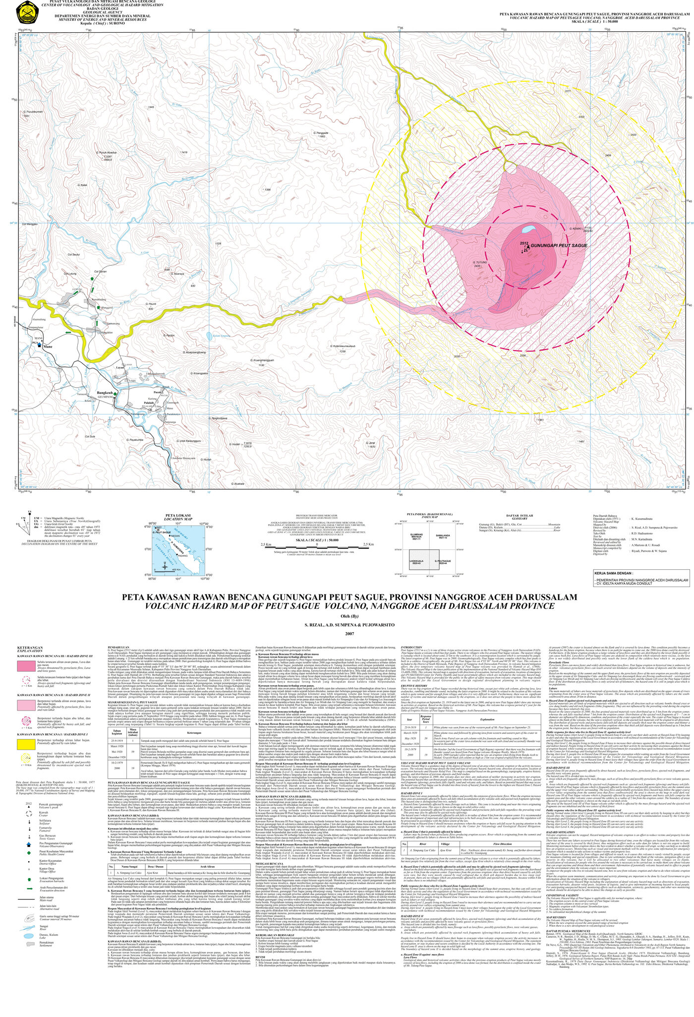
Official Geological Agency map (2007): areas that may be hit by pyroclastic flows, lava flows, ballistic rocks, ashfall, and lahars. KRB III is closest to the source.
14-day seismicity chart
Volcanic earthquakes per day by type.
View data table
| Date | Local tectonic |
|---|---|
| 25 Oct | 0 |
| 24 Oct | 0 |
| 23 Oct | 0 |
| 22 Oct | 0 |
| 21 Oct | 3 |
| 20 Oct | 0 |
| 19 Oct | 0 |
| 18 Oct | 0 |
| 17 Oct | 0 |
| 16 Oct | 0 |
| 15 Oct | 0 |
| 14 Oct | 0 |
| 13 Oct | 0 |
| 12 Oct | 0 |
Satellite imagery
Previous reports
24-hour report, 2026-10-22, 00:00-24:00 WIB
Visual: The volcano is clearly visible to covered by fog 0-III. Crater smoke not observed.
- Kegempaan nihil.
24-hour report, 2026-10-21, 00:00-24:00 WIB
Visual: The volcano is clearly visible to covered by fog 0-III. Crater smoke not observed.
- 3 Local tectonic events, amplitude 1.7-4 mm, S-P 1.7-3.8 s, duration 16-23 s.
24-hour report, 2026-10-20, 00:00-24:00 WIB
Visual: The volcano is clearly visible to covered by fog 0-II. No crater smoke.
- Kegempaan nihil.
24-hour report, 2026-10-19, 00:00-24:00 WIB
Visual: The volcano is clearly visible to covered by fog 0-III. No crater smoke.
- Kegempaan nihil.
24-hour report, 2026-10-18, 00:00-24:00 WIB
Visual: The volcano is covered by fog 0-III. Crater smoke not observed.
- Kegempaan nihil.
Level history
No level changes recorded since monitoring began.