
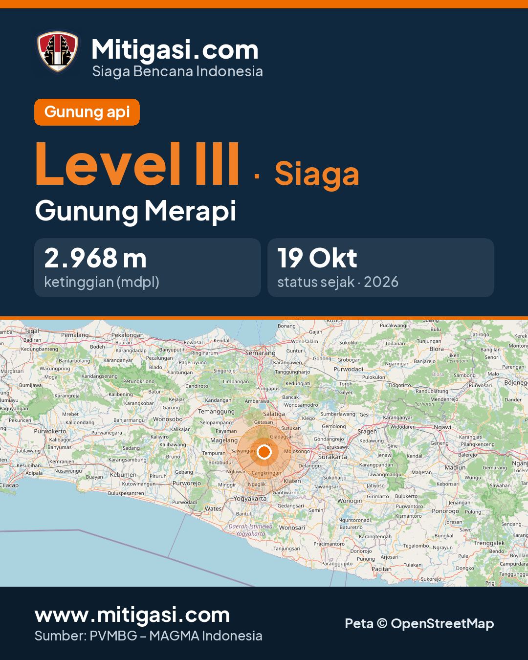
Mount Merapi
DI Yogyakarta and Jawa Tengah · 2.968 m a.s.l.
Recommendations
2. Data pemantauan menunjukkan suplai magma masih berlangsung yang dapat memicu terjadinya awanpanas guguran di dalam daerah potensi bahaya
3. Masyarakat agar tidak melakukan kegiatan apapun di daerah potensi bahaya.
4. Masyarakat agar mewaspadai bahaya lahar dan awanpanas guguran [ APG] terutama saat terjadi hujan di seputar G. Merapi.
5. Masyarakat agar mengantisipasi gangguan akibat abu vulkanik dari erupsi Gunung Merapi.
6. Jika terjadi perubahan aktivitas yang signifikan, maka status aktivitas Gunung Merapi akan segera ditinjau kembali.
Latest report
Laporan per 6 jam, tanggal 2026-10-24 pukul 18:00 - 24:00 WIB · Yulianto
Visual observation
The volcano is covered by fog 0-II to covered by fog 0-III. No crater smoke.
Climatology
Weather overcast, weak wind towards east and west. Air temperature about 17.5-19.8°C. Humidity 100%.
Seismicity
- 23 Rockfall events, amplitude 2-26 mm, duration 30.99-191.16 s.
- 11 Hybrid/multiphase events, amplitude 2-33 mm, S-P 0.3-0.6 s, duration 17.19-36.92 s.
Observation photo
Observation photo not available.
- Location
- Sleman, Magelang, Boyolali, Klaten, Daerah Istimewa Yogyakarta dan Jawa Tengah
- Nearest city
- Boyolali
- Elevation
- 2.968 m a.s.l.
- Coordinates
- -7.5420000, 110.4420000
Observation-post CCTV
Gunung Merapi belum memiliki CCTV publik.
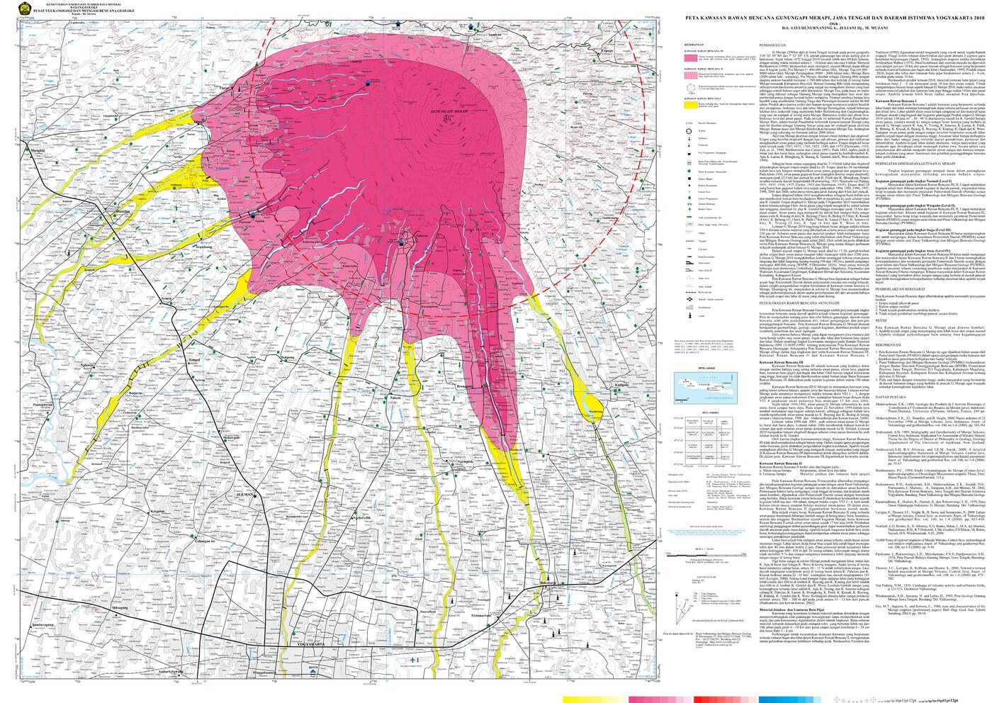
Volcanic hazard map (KRB)
Official Geological Agency map (2010): areas that may be hit by pyroclastic flows, lava flows, ballistic rocks, ashfall, and lahars. KRB III is closest to the source.
14-day seismicity chart
Volcanic earthquakes per day by type.
View data table
| Date | Rockfall | Shallow volcanic | Hybrid/multiphase | Distant tectonic | More |
|---|---|---|---|---|---|
| 25 Oct | 0 | 0 | 0 | 0 | 0 |
| 24 Oct | 111 | 4 | 99 | 0 | 0 |
| 23 Oct | 157 | 4 | 87 | 0 | 0 |
| 22 Oct | 166 | 13 | 90 | 6 | 1 |
| 21 Oct | 97 | 5 | 91 | 2 | 0 |
| 20 Oct | 116 | 10 | 103 | 7 | 0 |
| 19 Oct | 121 | 14 | 119 | 0 | 0 |
| 18 Oct | 0 | 0 | 0 | 0 | 0 |
| 17 Oct | 0 | 0 | 0 | 0 | 0 |
| 16 Oct | 0 | 0 | 0 | 0 | 0 |
| 15 Oct | 0 | 0 | 0 | 0 | 0 |
| 14 Oct | 0 | 0 | 0 | 0 | 0 |
| 13 Oct | 0 | 0 | 0 | 0 | 0 |
| 12 Oct | 0 | 0 | 0 | 0 | 0 |
Satellite imagery
Previous reports
Laporan per 6 jam, tanggal 2026-10-24 pukul 12:00 - 18:00 WIB
Visual: The volcano is covered by fog 0-III. No crater smoke.
- 9 Rockfall events, amplitude 2-32 mm, duration 35.42-123.17 s.
- 1 Tremor Non-Harmonik event, amplitude 4 mm, duration 76.85 s.
- 17 Hybrid/multiphase events, amplitude 2-44 mm, S-P not observed, duration 12.98-60.16 s.
Laporan per 6 jam, tanggal 2026-10-24 pukul 06:00 - 12:00 WIB
Visual: The volcano is covered by fog 0-III. No crater smoke.
- 15 Rockfall events, amplitude 2-11 mm, duration 35.63-195.17 s.
- 1 Tremor Non-Harmonik event, amplitude 19 mm, duration 81.31 s.
- 10 Hybrid/multiphase events, amplitude 3-25 mm, S-P 0.2-0.9 s, duration 17.64-46.58 s.
- 2 Shallow volcanic events, amplitude 5-7 mm, duration 14.44-22.8 s.
Laporan per 24 jam, tanggal 2026-10-24 pukul 00:00 - 24:00 WIB
Visual: The volcano is covered by fog 0-III. No crater smoke.
- 64 Rockfall events, amplitude 32 mm, duration 30.99-195.17 s.
- 2 Tremor Non-Harmonik events, amplitude 4-19 mm, duration 76.85-81.31 s.
- 61 Hybrid/multiphase events, amplitude 2-44 mm, S-P 0.3-0.6 s, duration 12.98-60.16 s.
- 2 Shallow volcanic events, amplitude 5-7 mm, duration 14.44-22.8 s.
24-hour report, 2026-10-24, 00:00-24:00 WIB
Visual: The volcano is covered by fog 0-II to covered by fog 0-III. Crater smoke not observed. Weather cloudy to overcast, weak wind to moderate towards north, east and west. Air temperature about 17.5-20.4°C. Humidity 95.5-100.0%. Air pressure 872.0-918.2 mmHg.
- 61 Hybrid/multiphase events, amplitude 2.0-44.0 mm, S-P 0.3-0.6 s, duration 12.98-60.16 s.
- 2 Shallow volcanic events, amplitude 5.0-7.0 mm, duration 14.44-22.8 s.
- 64 Rockfall events, amplitude 2.0-32.0 mm, duration 30.99-195.17 s.
- 2 Tremor Non-Harmonik events, amplitude 4.0-19.0 mm, duration 76.85-81.31 s.
Laporan per 6 jam, tanggal 2026-10-24 pukul 00:00 - 06:00 WIB
Visual: The volcano is covered by fog 0-III. No crater smoke.
- 16 Rockfall events, amplitude 2-5 mm, duration 44.45-170.69 s.
- 23 Hybrid/multiphase events, amplitude 2-28 mm, S-P not observed, duration 17.21-34.25 s.
Laporan per 6 jam, tanggal 2026-10-23 pukul 18:00 - 24:00 WIB
Visual: The volcano is covered by fog 0-III. No crater smoke.
- 21 Rockfall events, amplitude 2-47 mm, duration 51.38-217.97 s.
- 1 Tremor Non-Harmonik event, amplitude 42 mm, duration 51.02 s.
- 9 Hybrid/multiphase events, amplitude 2-25 mm, S-P 0.2-0.9 s, duration 19.64-59 s.
Laporan per 6 jam, tanggal 2026-10-23 pukul 12:00 - 18:00 WIB
Visual: The volcano is covered by fog 0-III. No crater smoke.
- 18 Rockfall events, amplitude 2-48 mm, duration 73.34-303.12 s.
- 21 Hybrid/multiphase events, amplitude 2-29 mm, S-P not observed, duration 9.78-33.94 s.
Level history
No level changes recorded since monitoring began.