
Mount Ibu
Maluku Utara · 1.325 m a.s.l.
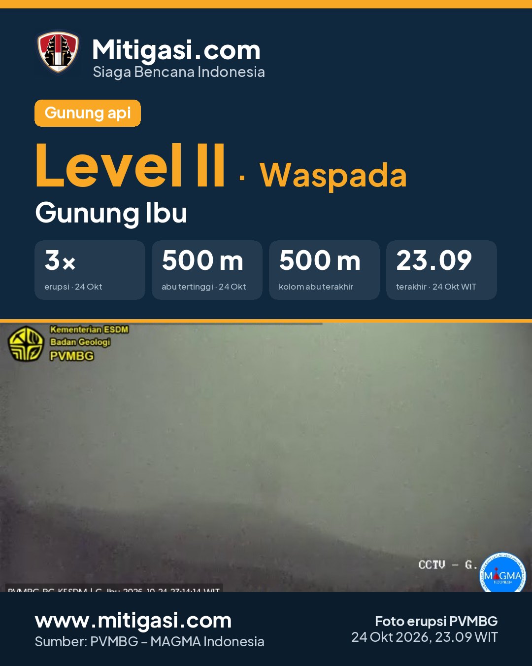
Erupsi terakhir 24 Oct 2026, 22:09 WITA
5 hours ago · waktu setempat 24 Okt 2026, 23:09 WIT
Telah terjadi erupsi G. Ibu,Maluku Utara pada hari Saturday, 24 October 2026, 23:09 WIT dengan tinggi kolom abu teramati ± 500 m di atas puncak (± 1825.0 m di atas permukaan laut). Kolom abu teramati berwarna kelabu dengan intensitas tebal ke arah barat laut. Letusan ini terekam di seismogram dengan amplitudo maksimum 28.0 mm dan durasi sementara +/- 53.0 detik.
PVMBG recommendations
1. Masyarakat di sekitar G. Ibu dan pengunjung/wisatawan agar tidak beraktivitas di dalam radius 2 km dan perluasan sektoral berjarak 3.5 km ke arah bukaan kawah di bagian utara dari kawah aktif G. Ibu. 2. Jika terjadi hujan abu, masyarakat yang beraktivitas di luar rumah disarankan untuk menggunakan pelindung hidung, mulut (masker) dan mata (kacamata). 3. Seluruh pihak agar menjaga kondusivitas suasana di masyarakat, tidak menyebarkan narasi bohong (hoax), dan tidak terpancing isu-isu yang tidak jelas sumbernya. Masyarakat agar selalu mengikuti arahan dari Pemerintah Daerah. 4. Pemerintah Kabupaten Halmahera Barat agar senantiasa berkoordinasi dengan Pusat Vulkanologi dan Mitigasi Bencana Geologi di Bandung atau dengan Pos Pengamatan G. Ibu di Gam Ici untuk mendapatkan informasi langsung tentang aktivitas G. Ibu. 5. Masyarakat, instansi pemerintah, maupun instansi terkait lainnya dapat memantau perkembangan aktivitas maupun rekomendasi G. Ibu melalui aplikasi android Magma Indonesia, website Magma Indonesia (www.vsi.esdm.go.id atau https://magma.esdm.go.id), dan media sosial PVMBG (facebook, twitter, dan instagram).

Recommendations
2. Jika terjadi hujan abu, masyarakat yang beraktivitas di luar rumah disarankan untuk menggunakan pelindung hidung, mulut (masker) dan mata (kacamata).
3. Seluruh pihak agar menjaga kondusivitas suasana di masyarakat, tidak menyebarkan narasi bohong (hoax), dan tidak terpancing isu-isu yang tidak jelas sumbernya. Masyarakat agar selalu mengikuti arahan dari Pemerintah Daerah.
4. Pemerintah Kabupaten Halmahera Barat agar senantiasa berkoordinasi dengan Pusat Vulkanologi dan Mitigasi Bencana Geologi di Bandung atau dengan Pos Pengamatan G. Ibu di Gam Ici untuk mendapatkan informasi langsung tentang aktivitas G. Ibu.
5. Masyarakat, instansi pemerintah, maupun instansi terkait lainnya dapat memantau perkembangan aktivitas maupun rekomendasi G. Ibu melalui aplikasi android Magma Indonesia, website Magma Indonesia (www.vsi.esdm.go.id atau https://magma.esdm.go.id), dan media sosial PVMBG (facebook, twitter, dan instagram).
Latest report
24-hour report, 2026-10-24, 00:00-24:00 WIT · M. Richard Chaniago
Visual observation
The volcano is clearly visible to covered by fog 0-III. Main crater smoke observed: white with thin to moderate intensity, rising about 100-200 meter dari puncak. Weather clear to cloudy, weak wind to moderate towards north and northwest. Air temperature about 22.9-30.6°C. Humidity 73.6-100.0%. Air pressure 751.5-754.7 mmHg.
Climatology
Weather clear to cloudy, weak wind to moderate towards north and northwest. Air temperature about 22.9-30.6°C. Humidity 73.6-100.0%. Air pressure 751.5-754.7 mmHg.
Seismicity
- 123 Low frequency events, amplitude 2.0-14.0 mm, duration 17.0-29.0 s.
- 15 Harmonik events, amplitude 2.0-10.0 mm, duration 23.0-123.0 s.
- 141 Shallow volcanic events, amplitude 2.0-11.0 mm, duration 7.0-26.0 s.
- 1 Emission event, amplitude 5.0 mm, duration 42.0 s.
- 18 Distant tectonic events, amplitude 2.0-28.0 mm, S-P not observed, duration 71.0-133.0 s.
- 3 Deep volcanic events, amplitude 2.0-15.0 mm, S-P 1.3-3.8 s, duration 16.0-26.0 s.
- 2 Local tectonic events, amplitude 2.0-4.0 mm, S-P 8.3-8.9 s, duration 32.0-36.0 s.
- 3 Rockfall events, amplitude 2.0-4.0 mm, duration 43.0-68.0 s.
- 129 Explosion/eruption events, amplitude 15.0-28.0 mm, duration 37.0-88.0 s.
Observation photo

Latest observation photo.
- Location
- Halmahera Barat, Maluku Utara
- Nearest city
- Jailolo
- Elevation
- 1.325 m a.s.l.
- Coordinates
- 1.4880000, 127.6300000
Eruptions in the last 30 days (12 terakhir)
- Ash column ± 500 m above the summit, duration 53 s
- Ash column ± 400 m above the summit, duration 83 s
- Ash column ± 300 m above the summit, duration 46 s
- Ash column ± 400 m above the summit, duration 43 s
- Ash column ± 300 m above the summit, duration 48 s
- Ash column ± 500 m above the summit, duration 60 s
- Ash column not observed
- Ash column ± 400 m above the summit, duration 50 s
- Ash column not observed
- Ash column not observed
- Ash column ± 500 m above the summit, duration 56 s
- Ash column ± 400 m above the summit, duration 54 s
VONA – Aviation Notice
Volcano Observatory Notice for Aviation issued by PVMBG for airlines: the colour code shows the volcanic-ash hazard to aircraft. Last 30 days.
-
ORANGE
24 Oct 2026, 20:37 WITA · 2026IBU297
Volcanic ash ±400 m above the summit, duration 83 seconds..
VONA text
Eruption with volcanic ash cloud at 1237 UTC (2137 local). Best estimate of ash-cloud top is around 5520 FT (1725 M) above sea level or 1280 FT (400 M) above summit. May be higher than what can be observed clearly. Source of height data: ground observer. Ash cloud moving to northwest.
-
ORANGE
21 Oct 2026, 19:17 WITA · 2026IBU296
Volcanic ash ±500 m above the summit.
VONA text
Eruption with volcanic ash cloud at 1117 UTC (2017 local). Best estimate of ash-cloud top is around 5840 FT (1825 M) above sea level or 1600 FT (500 M) above summit. May be higher than what can be observed clearly. Source of height data: ground observer. Ash cloud moving to north.
-
ORANGE
21 Oct 2026, 08:41 WITA · 2026IBU295
Volcanic ash ±400 m above the summit, duration 51 seconds..
VONA text
Eruption with volcanic ash cloud at 0041 UTC (0941 local). Best estimate of ash-cloud top is around 5520 FT (1725 M) above sea level or 1280 FT (400 M) above summit. May be higher than what can be observed clearly. Source of height data: ground observer. Ash cloud moving to north.
-
ORANGE
20 Oct 2026, 02:52 WITA · 2026IBU294
Volcanic ash ±300 m above the summit, duration 37 seconds..
VONA text
Eruption with volcanic ash cloud at 1852 UTC (0352 local). Best estimate of ash-cloud top is around 5200 FT (1625 M) above sea level or 960 FT (300 M) above summit. May be higher than what can be observed clearly. Source of height data: ground observer. Ash cloud moving to east.
-
ORANGE
18 Oct 2026, 04:42 WITA · 2026IBU293
Volcanic ash ±500 m above the summit, duration 58 seconds..
VONA text
Eruption with volcanic ash cloud at 2042 UTC (0542 local). Best estimate of ash-cloud top is around 5840 FT (1825 M) above sea level or 1600 FT (500 M) above summit. May be higher than what can be observed clearly. Source of height data: ground observer. Ash cloud moving to north.
Observation-post CCTV
Snapshots are updated about every 15 minutes. The capture time is shown in the top-left corner.


Live seismograms
Seismograph (helicorder) records from the last 24 hours at 5 PVMBG stations on Mount Ibu, updated about every 15 minutes. One line = 30 minutes; the bottom line is the latest. Times on the image are UTC (WIB = UTC+7, WITA = UTC+8, WIT = UTC+9). Click an image for full size.
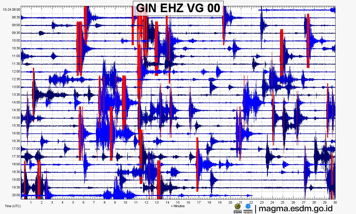
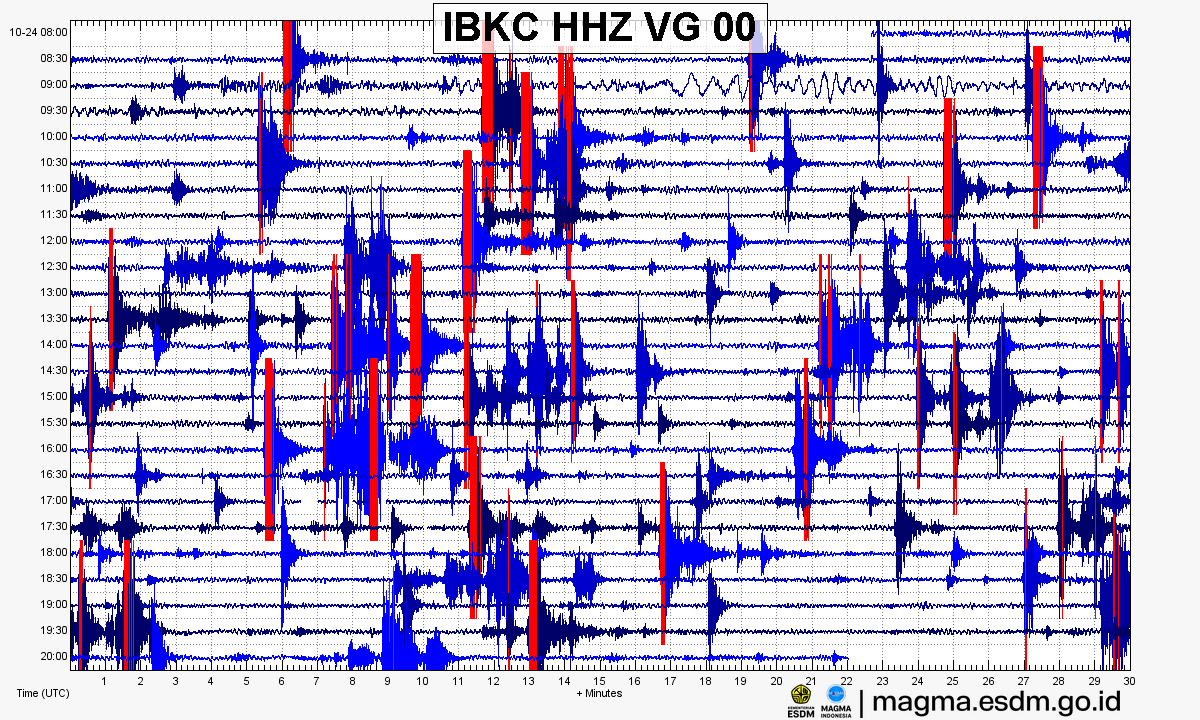
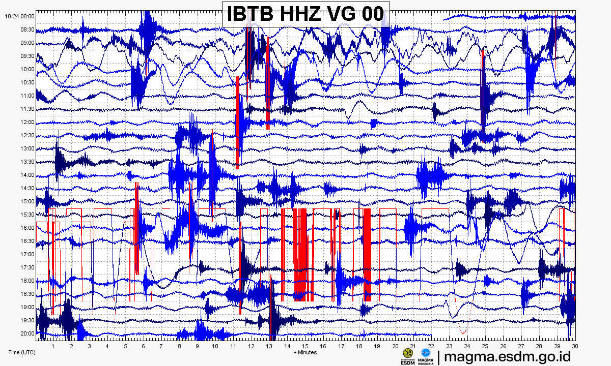
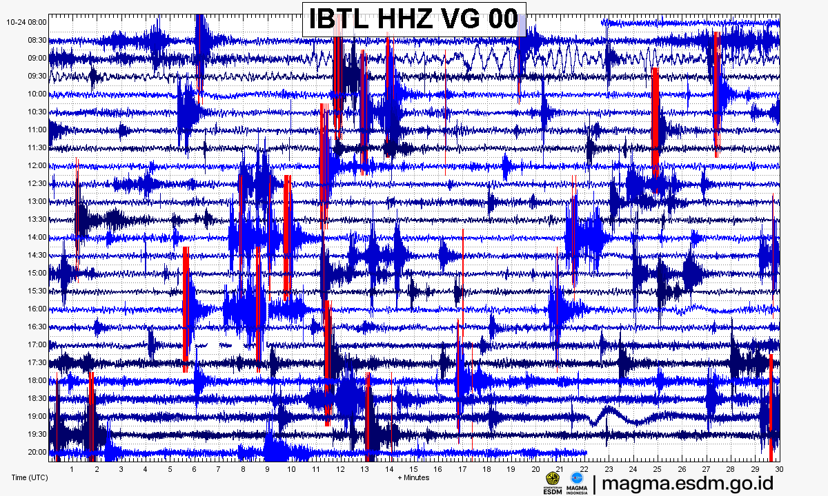
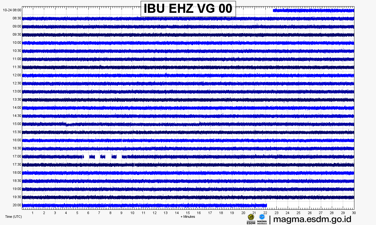
Source: PVMBG – MAGMA Indonesia. Volcanic earthquakes appear as spikes on the trace; continuous shaking may indicate tremor.
Volcanic hazard map (KRB)
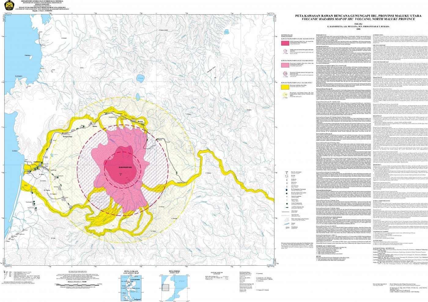
Official Geological Agency map (2008): areas that may be hit by pyroclastic flows, lava flows, ballistic rocks, ashfall, and lahars. KRB III is closest to the source.
14-day seismicity chart
Volcanic earthquakes per day by type.
View data table
| Date | Explosion/eruption | Rockfall | Emission | Shallow volcanic | Deep volcanic | Local tectonic | Distant tectonic | More |
|---|---|---|---|---|---|---|---|---|
| 25 Oct | 0 | 0 | 0 | 0 | 0 | 0 | 0 | 0 |
| 24 Oct | 0 | 0 | 0 | 0 | 0 | 0 | 0 | 0 |
| 23 Oct | 129 | 3 | 1 | 141 | 3 | 2 | 18 | 123 |
| 22 Oct | 106 | 1 | 1 | 104 | 2 | 3 | 20 | 151 |
| 21 Oct | 98 | 2 | 1 | 129 | 1 | 0 | 18 | 103 |
| 20 Oct | 112 | 4 | 1 | 153 | 1 | 3 | 12 | 117 |
| 19 Oct | 77 | 1 | 1 | 131 | 0 | 1 | 8 | 107 |
| 18 Oct | 107 | 0 | 3 | 123 | 0 | 2 | 9 | 87 |
| 17 Oct | 101 | 1 | 3 | 167 | 2 | 1 | 12 | 134 |
| 16 Oct | 0 | 0 | 0 | 0 | 0 | 0 | 0 | 0 |
| 15 Oct | 0 | 0 | 0 | 0 | 0 | 0 | 0 | 0 |
| 14 Oct | 0 | 0 | 0 | 0 | 0 | 0 | 0 | 0 |
| 13 Oct | 0 | 0 | 0 | 0 | 0 | 0 | 0 | 0 |
| 12 Oct | 0 | 0 | 0 | 0 | 0 | 0 | 0 | 0 |
Satellite imagery
Previous reports
24-hour report, 2026-10-23, 00:00-24:00 WIT
Visual: The volcano is clearly visible to covered by fog 0-III. Main crater smoke observed: white with thin to moderate intensity, rising about 100-200 meter dari puncak.
- 106 Explosion/eruption events, amplitude 15-28 mm, duration 31-71 s.
- 1 Rockfall event, amplitude 2 mm, duration 49 s.
- 1 Emission event, amplitude 8 mm, duration 42 s.
- 14 Harmonik events, amplitude 2-20 mm, duration 41-124 s.
- 151 Low frequency events, amplitude 2-12 mm, duration 17-29 s.
- 104 Shallow volcanic events, amplitude 2-6 mm, duration 7-26 s.
- 2 Deep volcanic events, amplitude 4-13 mm, S-P 1.4-2.6 s, duration 17-23 s.
- 3 Local tectonic events, amplitude 2-10 mm, S-P 4.8-7.8 s, duration 30-45 s.
- 20 Distant tectonic events, amplitude 2-28 mm, S-P not observed, duration 40-143 s.
24-hour report, 2026-10-22, 00:00-24:00 WIT
Visual: The volcano is clearly visible to covered by fog 0-III. Main crater smoke observed: white with thin to moderate intensity, rising about 100-200 meter dari puncak.
- 98 Explosion/eruption events, amplitude 15-28 mm, duration 34-113 s.
- 2 Rockfall events, amplitude 6 mm, duration 29-41 s.
- 1 Emission event, amplitude 10 mm, duration 36 s.
- 5 Harmonik events, amplitude 2-10 mm, duration 35-90 s.
- 103 Low frequency events, amplitude 2-12 mm, duration 17-29 s.
- 129 Shallow volcanic events, amplitude 2-8 mm, duration 7-21 s.
- 1 Deep volcanic event, amplitude 8 mm, S-P 1.6 s, duration 23 s.
- 18 Distant tectonic events, amplitude 2-28 mm, S-P not observed, duration 31-82 s.
24-hour report, 2026-10-21, 00:00-24:00 WIT
Visual: The volcano is clearly visible to covered by fog 0-III. Main crater smoke observed: white with thin to moderate intensity, rising about 100-200 meter dari puncak.
- 112 Explosion/eruption events, amplitude 15-28 mm, duration 34-82 s.
- 4 Rockfall events, amplitude 3 mm, duration 37-67 s.
- 1 Emission event, amplitude 2 mm, duration 47 s.
- 14 Harmonik events, amplitude 2-28 mm, duration 48-100 s.
- 117 Low frequency events, amplitude 2-14 mm, duration 17-29 s.
- 153 Shallow volcanic events, amplitude 2-6 mm, duration 7-34 s.
- 1 Deep volcanic event, amplitude 2 mm, S-P 1.4 s, duration 16 s.
- 3 Local tectonic events, amplitude 4-28 mm, S-P 6.1-9.2 s, duration 29-50 s.
- 12 Distant tectonic events, amplitude 2-28 mm, S-P not observed, duration 32-112 s.
24-hour report, 2026-10-20, 00:00-24:00 WIT
Visual: The volcano is clearly visible to covered by fog 0-II. Main crater smoke observed: grey with thin to moderate intensity, rising about 100-300 meter dari puncak.
- 77 Explosion/eruption events, amplitude 15-28 mm, duration 32-106 s.
- 1 Rockfall event, amplitude 8 mm, duration 51 s.
- 1 Emission event, amplitude 20 mm, duration 34 s.
- 18 Harmonik events, amplitude 2-20 mm, duration 36-85 s.
- 107 Low frequency events, amplitude 2-15 mm, duration 13-29 s.
- 131 Shallow volcanic events, amplitude 2-10 mm, duration 12-21 s.
- 1 Local tectonic event, amplitude 10 mm, S-P 4.26 s, duration 17 s.
- 8 Distant tectonic events, amplitude 3-28 mm, S-P not observed, duration 53-93 s.
24-hour report, 2026-10-19, 00:00-24:00 WIT
Visual: The volcano is clearly visible to covered by fog 0-III. Main crater smoke observed: white with thin to moderate intensity, rising about 100-200 meter dari puncak.
- 107 Explosion/eruption events, amplitude 15-28 mm, duration 33-83 s.
- 3 Emission events, amplitude 7-10 mm, duration 36-42 s.
- 5 Harmonik events, amplitude 2-20 mm, duration 42-76 s.
- 87 Low frequency events, amplitude 2-12 mm, duration 17-29 s.
- 123 Shallow volcanic events, amplitude 2-8 mm, duration 7-21 s.
- 2 Local tectonic events, amplitude 12-20 mm, S-P 7.8-8 s, duration 27-35 s.
- 9 Distant tectonic events, amplitude 5-28 mm, S-P not observed, duration 33-149 s.
24-hour report, 2026-10-18, 00:00-24:00 WIT
Visual: The volcano is clearly visible to covered by fog 0-III. Main crater smoke observed: white with thin to moderate intensity, rising about 100-200 meter dari puncak.
- 101 Explosion/eruption events, amplitude 15-28 mm, duration 31-69 s.
- 1 Rockfall event, amplitude 3 mm, duration 43 s.
- 3 Emission events, amplitude 4-7 mm, duration 32-41 s.
- 8 Harmonik events, amplitude 2-12 mm, duration 41-76 s.
- 134 Low frequency events, amplitude 2-10 mm, duration 17-29 s.
- 167 Shallow volcanic events, amplitude 2-6 mm, duration 7-21 s.
- 2 Deep volcanic events, amplitude 2-28 mm, S-P 1.5-3.8 s, duration 119-42 s.
- 1 Local tectonic event, amplitude 2 mm, S-P 7.4 s, duration 32 s.
- 12 Distant tectonic events, amplitude 2-28 mm, S-P not observed, duration 42-103 s.
Level history
No level changes recorded since monitoring began.