
Mount Hobal
Nusa Tenggara Timur · -50 mdpl
Level I (Normal)
Level I – Normal
No sign of increased activity. Normal community activities.
Status changed: 19 Oct 2026, 16:17 WITA
Recommendations
1. Masyarakat di sekitar G. Ile Werung maupun pengunjung/wisatawan untuk mewaspadai di sekitar area lokasi bualan 29 November 2021. Masyarakat direkomendasikan untuk tidak mendekati dan mengunjungi kawah puncak G. Ile Werung.
2. Pemerintah Daerah (BPBD) agar selalu berkoordinasi dengan Pos Pengamatan G. Ile Werung yang berada di Desa Tubuk Rajan, Kecamatan Atadei, Kabupaten Lembata, NTT atau dengan Pusat Vulkanologi dan Mitigasi Bencana Geologi di Bandung.
3. Masyarakat agar tidak terpancing dengan berita yang tidak jelas sumbernya (Hoaks).
Informasi mengenai aktivitas gunung api, gempabumi, dan gerakan tanah di Indonesia terkini dapat diperoleh melalui aplikasi/Website Magma Indonesia (https://magma.esdm.go.id) dan media sosial PVMBG (Facebook, Twitter, dan Instagram pvmbg_).
Latest report
24-hour report, 2025-08-05, 00:00-24:00 WITA · Wilson Wuri Wuthun
Visual observation
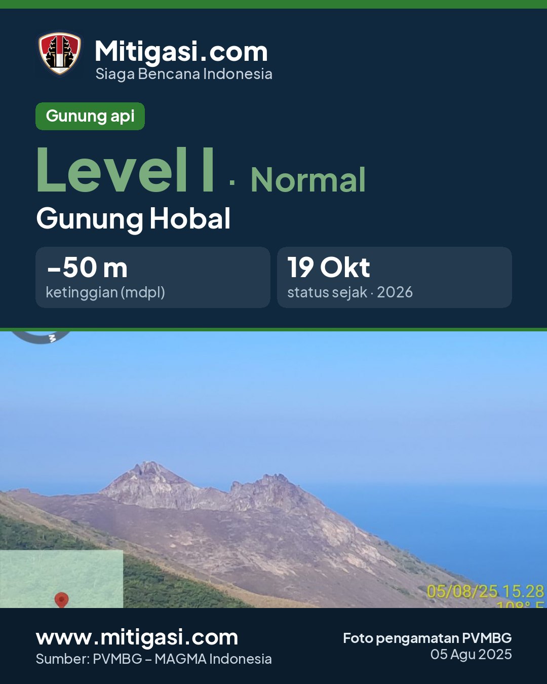
The volcano is clearly visible. No crater smoke.
Climatology
Weather clear to cloudy, weak wind towards northeast. Air temperature about 21-26°C.
Seismicity
- 1 Terasa, skala I MMI event, amplitude 34.5 mm, S-P not observed, duration 78 s.
- 5 Distant tectonic events, amplitude 4-22 mm, S-P 11-13 s, duration 21-145 s.
Observation photo

Latest observation photo.
- Location
- Lembata, Nusa Tenggara Timur
- Nearest city
- Lembata
- Elevation
- -50 mdpl
- Coordinates
- -8.5444000, 123.5850000
Observation-post CCTV
Gunung Hobal belum memiliki CCTV publik.
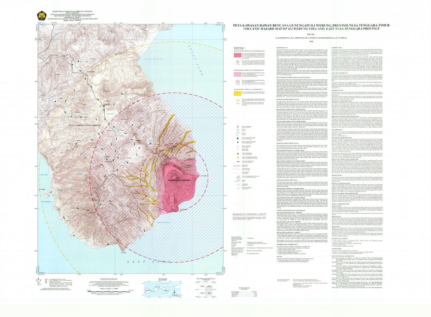
Volcanic hazard map (KRB)
Official Geological Agency map (2010): areas that may be hit by pyroclastic flows, lava flows, ballistic rocks, ashfall, and lahars. KRB III is closest to the source.
14-day seismicity chart
Volcanic earthquakes per day by type.
No seismic data recorded yet.
Satellite imagery
Choose a layer in the top-right corner of the map. Daily images may be cloudy.
Previous reports
Belum ada laporan sebelumnya.
Level history
No level changes recorded since monitoring began.