
Mount Ebulobo
Nusa Tenggara Timur · 2.124 m a.s.l.
Recommendations
2. Masyarakat yang ada di sekitar G. Ebulobo dan seluruh pihak agar menjaga kondusifitas suasana di masyarakat, tidak menyebarkan narasi bohong (hoax) dan tidak terpancing isu-isu yang tidak jelas sumbernya. Masyarakat harap selalu mengikuti arahan dari Pemerintah Daerah.
3. Pemerintah Daerah Provinsi/Kabupaten agar selalu berkoordinasi dengan Pos Pengamatan G. Ebulobo yang berada di Desa Kelewae, Kecamatan Boawae, Kabupaten Nagekeo, Nusa Tenggara Timur atau dengan Pusat Vulkanologi dan Mitigasi Bencana Geologi, Badan Geologi di Bandung.
4. Informasi dan perkembangan aktivitas vulkanik G. Ebulobo dapat diakses melalui aplikasi MAGMA Indonesia yang dapat diunduh di Google Playstore atau melalui website https://magma.esdm.go.id, https://vsi.esdm.go.id dan website Badan Geologi https://geologi.esdm.go.id serta media sosial Badan Geologi.
Latest report
24-hour report, 2026-10-24, 00:00-24:00 WITA · J.C.R. Rionanda Adyaksa Putra
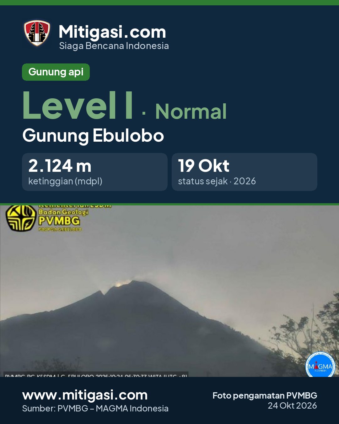
Visual observation
The volcano is clearly visible to covered by fog 0-III. Main crater smoke observed: white with thin intensity, rising about 25-50 meter dari puncak. Weather clear to overcast, weak wind to moderate towards east. Air temperature about 18.0-27.0°C. Humidity 64.0-93.0%. Air pressure 757.0-759.0 mmHg.
Carrier Off Di Lapangan
Climatology
Weather clear to overcast, weak wind to moderate towards east. Air temperature about 18.0-27.0°C. Humidity 64.0-93.0%. Air pressure 757.0-759.0 mmHg.
Seismicity
Tidak ada data kegempaan.
Observation photo

Latest observation photo.
- Location
- Nagekeo, Nusa Tenggara Timur
- Nearest city
- Boa Wae
- Elevation
- 2.124 m a.s.l.
- Coordinates
- -8.8200000, 121.1800000
Observation-post CCTV
Gunung Ebulobo belum memiliki CCTV publik.
Live seismograms
Seismograph (helicorder) records from the last 24 hours at 1 PVMBG stations on Mount Ebulobo, updated about every 15 minutes. One line = 30 minutes; the bottom line is the latest. Times on the image are UTC (WIB = UTC+7, WITA = UTC+8, WIT = UTC+9). Click an image for full size.
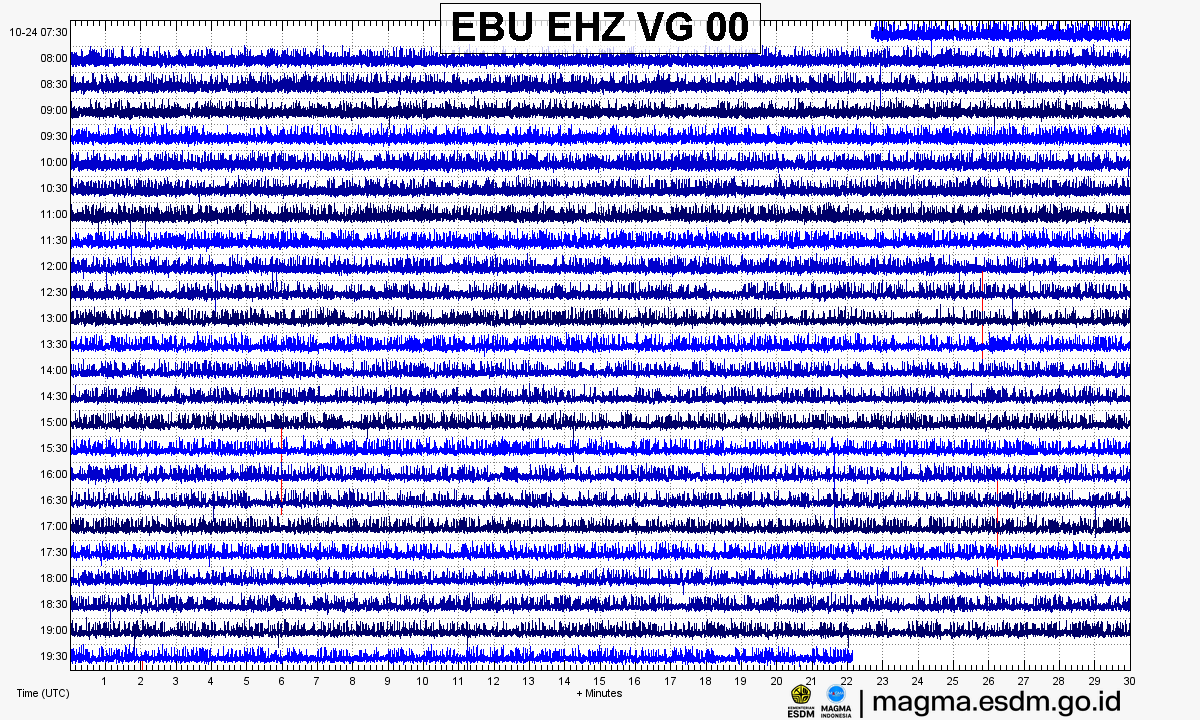
Source: PVMBG – MAGMA Indonesia. Volcanic earthquakes appear as spikes on the trace; continuous shaking may indicate tremor.
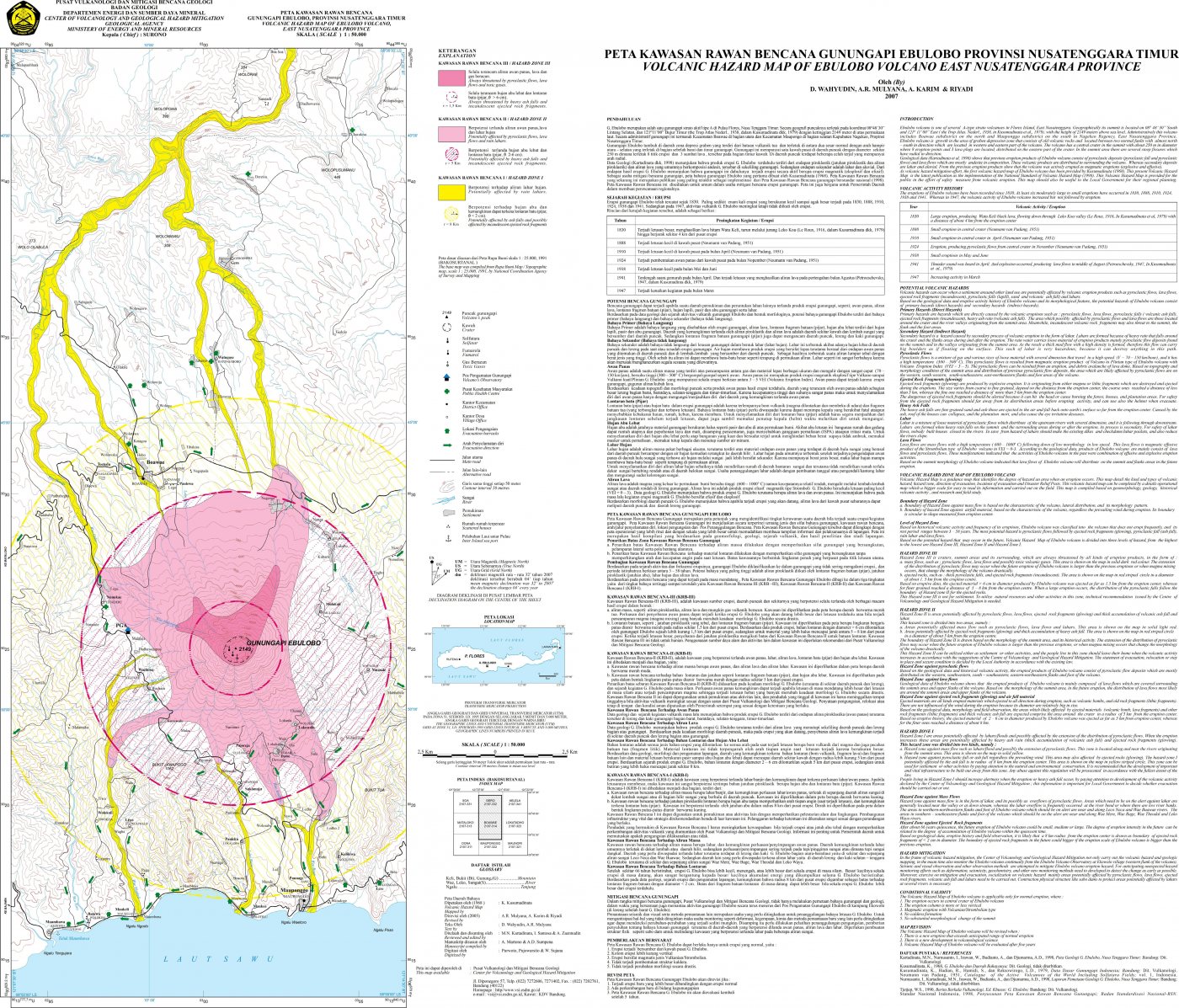
Volcanic hazard map (KRB)
Official Geological Agency map (2007): areas that may be hit by pyroclastic flows, lava flows, ballistic rocks, ashfall, and lahars. KRB III is closest to the source.
14-day seismicity chart
Volcanic earthquakes per day by type.
No seismic data recorded yet.
Satellite imagery
Previous reports
24-hour report, 2026-10-23, 00:00-24:00 WITA
Visual: The volcano is clearly visible to covered by fog 0-III. Main crater smoke observed: white with thin intensity, rising about 10-15 meter dari puncak.
- Kegempaan nihil.
24-hour report, 2026-10-22, 00:00-24:00 WITA
Visual: The volcano is clearly visible to covered by fog 0-III. Main crater smoke observed: white with thin intensity, rising about 10-15 meter dari puncak.
- Kegempaan nihil.
24-hour report, 2026-10-21, 00:00-24:00 WITA
Visual: The volcano is clearly visible to covered by fog 0-III. Main crater smoke observed: white with thin intensity, rising about 10-15 meter dari puncak.
- Kegempaan nihil.
24-hour report, 2026-10-20, 00:00-24:00 WITA
Visual: The volcano is clearly visible to covered by fog 0-III. Main crater smoke observed: white with thin intensity, rising about 10-15 meter dari puncak.
- Kegempaan nihil.
24-hour report, 2026-10-19, 00:00-24:00 WITA
Visual: The volcano is clearly visible to covered by fog 0-III. Main crater smoke observed: white with thin intensity, rising about 10-15 meter dari puncak.
- Kegempaan nihil.
24-hour report, 2026-10-18, 00:00-24:00 WITA
Visual: The volcano is clearly visible to covered by fog 0-III. Main crater smoke observed: white with thin intensity, rising about 10-15 meter dari puncak.
- Kegempaan nihil.
Level history
No level changes recorded since monitoring began.