
Mount Ili Boleng
Nusa Tenggara Timur · 1.659 m a.s.l.
Recommendations
1. Masyarakat di sekitar G. Ili Boleng dan pengunjung/wisatawan agar tidak beraktivitas dalam radius 500 meter dari pusat kawah utama di puncak G. Ili Boleng.
2. Untuk informasi lebih lanjut dapat menghubungi Pusat Vulkanologi dan Mitigasi Bencana Geologi, Badan Geologi di Bandung, Jawa Barat di nomor telepon (022) 7272606 atau Pos Pengamatan G. Ili Boleng di Wotan, Kelurahan Waiwerang kota, Kecamatan Adonara Timur, Flores Timur.
3. Masyarakat, pemerintah daerah, dan instansi terkait lainnya dapat memantau perkembangan aktivitas dan rekomendasi G. Ili Boleng melalui website Badan Geologi https://geologi.esdm.go.id, website Magma Indonesia https://magma.esdm.go.id, aplikasi Magma Indonesia yang dapat diunduh dari Google Playstore, atau melalui media sosial Badan Geologi (facebook, X, instagram, dan youtube).
Tingkat aktivitas G. Ili Boleng akan dievaluasi kembali secara berkala atau jika terjadi perubahan aktivitas yang signifikan. Tingkat aktivitas dan rekomendasi G. Ili Boleng ini tetap berlaku selama surat/laporan evaluasi berikutnya belum diterbitkan.
Latest report
24-hour report, 2026-10-23, 00:00-24:00 WITA · Agustinus Ola Bainauk Ratimakin
Visual observation
The volcano is covered by fog 0-I to covered by fog 0-III. No crater smoke.
Climatology
Weather clear to cloudy, weak wind to moderate towards southwest and west. Air temperature about 22-29°C.
Seismicity
- 2 Local tectonic events, amplitude 3.2-5.2 mm, S-P 3.1-3.5 s, duration 23-31.5 s.
- 2 Distant tectonic events, amplitude 1.3-1.6 mm, S-P 15.7-62 s, duration 62-142 s.
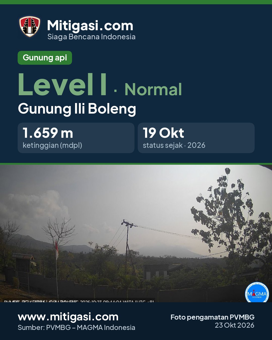
Observation photo

Latest observation photo.
- Location
- Flores Timur, Nusa Tenggara Timur
- Nearest city
- Wai Werang
- Elevation
- 1.659 m a.s.l.
- Coordinates
- -8.3420000, 123.2580000
Observation-post CCTV
Gunung Ili Boleng belum memiliki CCTV publik.
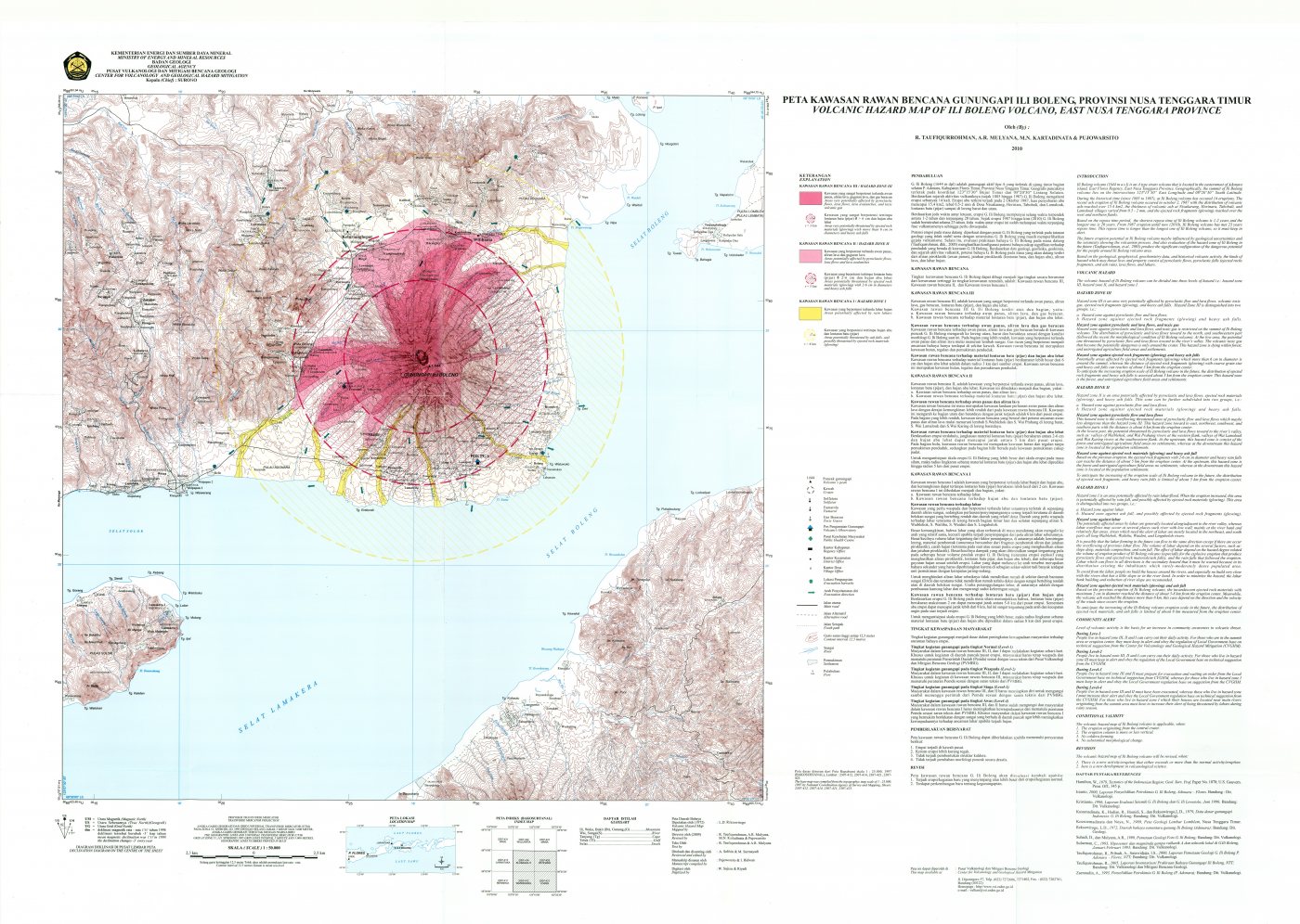
Volcanic hazard map (KRB)
Official Geological Agency map (2010): areas that may be hit by pyroclastic flows, lava flows, ballistic rocks, ashfall, and lahars. KRB III is closest to the source.
14-day seismicity chart
Volcanic earthquakes per day by type.
View data table
| Date | Deep volcanic | Local tectonic | Distant tectonic |
|---|---|---|---|
| 25 Oct | 0 | 0 | 0 |
| 24 Oct | 0 | 0 | 0 |
| 23 Oct | 0 | 2 | 2 |
| 22 Oct | 0 | 0 | 0 |
| 21 Oct | 0 | 0 | 1 |
| 20 Oct | 1 | 3 | 1 |
| 19 Oct | 0 | 0 | 3 |
| 18 Oct | 1 | 0 | 1 |
| 17 Oct | 0 | 0 | 0 |
| 16 Oct | 0 | 0 | 0 |
| 15 Oct | 0 | 0 | 0 |
| 14 Oct | 0 | 0 | 0 |
| 13 Oct | 0 | 0 | 0 |
| 12 Oct | 0 | 0 | 0 |
Satellite imagery
Previous reports
24-hour report, 2026-10-22, 00:00-24:00 WITA
Visual: The volcano is clearly visible to covered by fog 0-III. No crater smoke.
- Kegempaan nihil.
24-hour report, 2026-10-21, 00:00-24:00 WITA
Visual: The volcano is clearly visible to covered by fog 0-III. No crater smoke.
- 1 Distant tectonic event, amplitude 10.9 mm, S-P not observed, duration 164 s.
24-hour report, 2026-10-20, 00:00-24:00 WITA
Visual: The volcano is clearly visible to covered by fog 0-III. No crater smoke.
- 1 Deep volcanic event, amplitude 11.2 mm, S-P 1 s, duration 21 s.
- 3 Local tectonic events, amplitude 5.2-19.7 mm, S-P 4-8 s, duration 31-53 s.
- 1 Distant tectonic event, amplitude 7.1 mm, S-P 15 s, duration 77 s.
24-hour report, 2026-10-19, 00:00-24:00 WITA
Visual: The volcano is covered by fog 0-I to covered by fog 0-III. No crater smoke.
- 3 Distant tectonic events, amplitude 3.5-12.5 mm, S-P 18 s, duration 68-192 s.
24-hour report, 2026-10-18, 00:00-24:00 WITA
Visual: The volcano is covered by fog 0-II to covered by fog 0-III. No crater smoke.
- 1 Deep volcanic event, amplitude 7 mm, S-P 1 s, duration 19 s.
- 1 Distant tectonic event, amplitude 24 mm, S-P not observed, duration 158 s.
Level history
No level changes recorded since monitoring began.